by Donna Griffin-Smith
September 11, 2001 will remain in my memory as a day of startling contrasts. It started off on an emotional high. For us, it was calm, clear and sunny at 7 a.m., the beginning of a perfect paddling day and the final day of our trip in the North Channel. It ended with the devastating news and TV images of the attack on the National Trade Centre that crushed our sense of euphoria like a burst balloon.
Six days earlier our group of five paddlers (Bill, Elke, John, Don and myself) had launched at Spider Bay Marina in Little Current on Manitoulin Island. It was a bright sunny day with moderate winds; our boats were packed and we were on the water by early afternoon. We paddled westward in the main boat channel and then headed north along the eastern side of West Rous Island in order to avoid the westerly headwind, which was building as the afternoon progressed. At the north end of East Rous we stopped for a short rest and snack, then continued in a westerly direction to the north end of Bedford Island with the intention of locating a campsite.
The islands in this area, like Manitoulin Island to the south, are made of limestone, with flat terrain and low rocky shorelines bordered by forests that hug the waterline. In the distance along the North shore we could see the white rocks of the La Cloche Mountains. That afternoon choppy waves pounded the shoreline as we paddled on and on, with no likely landing spots in sight. However the map showed one possibility. A small point jutting out and the hopeful sounding name, Landing Beach.
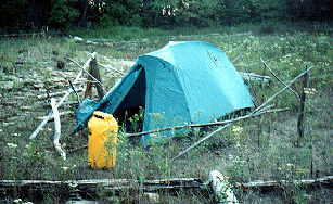
And indeed it was aptly named. A sheltered, sandy beach provided a perfect landing for the kayaks and beyond, in the shelter of large trees lay a small meadow of grasses and wild flowers. At high water levels this was probably a small bay, but with the recent low water levels it was high and dry. Deer tracks in the sand, a flock of Canada geese as well as signs of human visitors indicated it was a spot favoured by many. A special discovery for me was to find a large number of purple gentians growing there – the first time I had seen these flowers, which I knew by name only, from a poem I had memorized when I was a child.

We quickly turned the meadow into a campsite, complete with a bear fence erected around one of the tents. (Just ask Bill). All that night the wind blew, the sky was clear and a full moon shone so brightly it could be seen through the tent, and those who ventured out during the night to answer nature’s call could see their shadows. No bears came to call so I guess the bear fence worked.
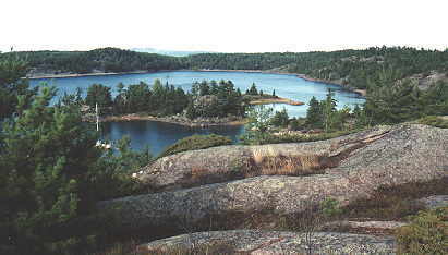
The next day we continued to the west, paddling along the north side of Ameroz Island and crossing over to Croker Island. In contrast to the islands to the south, this one greeted us with a high granite headland topped with the quintessential Georgian Bay pines. As we rounded the south western tip it opened into a large sheltered bay, at the end of which we found the almost perfect campsite – a long sand beach with room for many tents among the pines, but this site was well used. A decrepit (but usable) outhouse, numerous fire pits and remnants of old lawn chairs and coolers spoiled its beauty, but when we turned our backs to the junk and faced the western view of islands, water and sky, we knew we would stay. Later that afternoon, Elke and I paddled across the bay to a small inlet where several sailboats and cruisers were anchored for the night. Here we climbed up and hiked along the high rocks that formed the southern rampart of the island. From our lookout we could see the expanse of Manitoulin Island to the south and the sparkling waters and islands of the channel to the west.
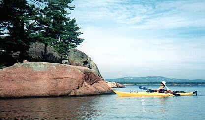
The next morning we awoke to cloudy skies and a rain shower. Fortunately we had put up our tarp the night before. We decided to stay at this site for another night, but when the rain let up we set out for a day paddle to the nearby Benjamin Islands. First we explored the southern and western sides of South Benjamin Island, passing many possible campsites, small beaches and an amazing wave-sculpted granite shoreline. At North Benjamin we met three fellow kayakers and passed a pleasant hour in conversation, learning about some of the special features of the Benjamins. These pink granite islands are a favourite destination for boaters and during the peak summer season the large bay between the two islands is often crowded with anchored boats. But on this day in early September, only three sailboats occupied its pleasant harbour. Across the bay on the south island we hiked up a huge smooth rock formation, then followed a trail across the island to look down on a deep cove with sheer rocky sides that indented the south side of the island. Earlier we had paddled right past it without noticing. By noon the weather had changed to hot and sunny so we completed the circumnavigation of the north island at a leisurely pace and returned to Croker.

The next day we packed up and paddled farther west, passing by the north end of the Benjamins, and along the channel between Eagle Island and Frechette Island. Just west of Eagle Island, at Crooks Island, we found our next campsite. Facing north on a cobbled beach, it offered shelter from the wind and threatening skies that were forming to the west. With our tents and tarp pitched we settled in to a peaceful afternoon of reading, exploring, and gathering driftwood for our evening campfire. A very quick swim in the frigid lake helped to relieve the humidity – besides it was time for a bath!
After studying our maps, we decided to turn eastward the next day. We followed the McBean Channel and then went along the north side of Hotham Island to McBean Harbour where there is a small community of homes and cottages. All along the North mainland shore here is the Sagamok Indian Reserve.
The morning started out very warm and calm and I remember the magic of paddling close to the shoreline, watching the perfect mirror reflections of trees in the water. But by afternoon, as we left the shelter of islands and travelled along an open stretch of shoreline the wind picked up again. By the time we reached our next campsite at McTavish Island we were paddling into a strong headwind.
Our sheltered campsite on the north side of McTavish Island had a lovely sand beach and spots for several tents. Behind the beach, the island is composed of a series of raised cobble beaches, and at the top were several pit-like structures, reminiscent of those found on Lake Superior. However the stones were not lichen covered and the pits seemed to have been recently constructed. As well there had been a recent fire on the island and several large pines had been toppled by the blaze. While exploring the interior of one hollow trunk, Elke was surprised to meet face to face with a raccoon. Later the curious fellow overcame his fright and visited her tent.
The strong winds continued through the night and the next morning threatened thunderstorms. However we packed up the tents and started out, deciding to paddle as far as we could as we had only two days left. We had only just started to paddle when we were overtaken by a heavy rain shower, so we altered course and headed for shelter at Fort LaCloche. Located in La Cloche Provincial Park on the north shore, this historic site was once a fur trading post, and more recently a Junior Ranger Camp. Now the buildings are used as a community centre by the natives of the Sagamok Reserve.
By the time we reached the camp, the sun was shining and the storm had passed. We had lunch by a small waterfall and then took a short hike along a trail that followed the river to La Cloche Lake and a dam, which was marked on our topo maps but turned out to be just a barrier of rocks in the river. Back at the camp we prepared to paddle on, but just as we reached the mouth of the river we saw another huge thunderstorm approaching from the west. We returned to the camp and took shelter on the porch of the rec centre until the storm passed. By 4:00 p.m. we were finally able to continue on, and after paddling for about an hour located a picturesque campsite on the southeast tip of Louisa Island. By evening the storms has passed and we enjoyed our last evening, lying on the flat rocks and stargazing.
Tuesday September 11 started the same as any other day. We were up early, the sky was clear and there was no wind. By 10:30 we were paddling, crossing the wide North Channel towards Bedford Harbour with an ever-increasing west wind blowing waves on our right side. After a lunch break at Bedford Island, we fought a strong headwind as we paddled south to the main channel. By the time we turned eastward, the waves coming from the stern were huge and rolling, about 1 metre high, but not breaking. I remember thinking we were crazy to be out there, but I also remember that it was challenging and exciting, and I don’t remember feeling frightened or in danger. It was a fun ride!
As we neared the boat channel leading in to Little Current, three military helicopters passed overhead. At the marina we packed the cars and headed for the showers. Then we went to the lounge where the TV was on. The news was shocking. September 11, 2001: the end of a great trip, the beginning of a new era.
